Professor Ian Ralston
Projects


Permission was granted by Mr Lloyd Cormie to investigate the garden of 22, Church Street. This occupies a corner site at the junction with King Street, and is located at a little over 11m OD. It is the nearest unscheduled accessible land to the site of the Burghead well, the walled precinct of which lies some twenty metres to the WNW. As this garden runs at right angles approximately to the indicated line of the triple system, it was hoped that traces of one or more of the banks, or more feasibly the ditches, might be detected below the level of modern garden soil and detritus stored in the garden.
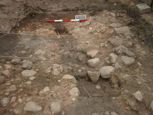
A substantial portion of the garden on the N side of the property as far as the boundary fence with the adjacent property to the WNW was stripped of garden soil to the cobbled surface of the subjacent geomorphological layer. Only the SE corner, adjacent to the house and to Church Street itself was not touched as it had a concrete raft (former garage). The area examined was some 14 m E/W by 6 m in extent.
All finds were modern, and included quantities of comminuted sea shells. One area had previously accommodated a dry toilet / soakaway. Apart from a small modern service trench containing a copper pipe (Fig 4), the modern waste pipe from the house, and the settings for washing line poles, there were no features of archaeological interest apparent as negative features in the subsoil.
Topsoil and modern debris was removed from the site by tractor and trailer (Dan Ralph) and, in agreement with the owner, matting was laid down and gravel spread over the former garden by way of reinstatement.

Fig 4 Detail of the garden at 22, Church Street – trench with modern copper pipe cut into the subsoil
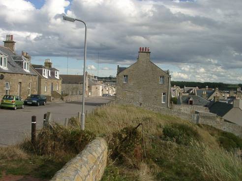
In all, four trenches were examined in the gardens that now form part of the property at the Brae, 35, Grant Street by courtesy of Mr Gilbert Fraser. The Brae is the house furthest to the NW on the W side of Grant Street (Figs 2, 3 and 5), and is positioned at the top of the slope which drops steeply to the SW towards the harbour. The three gardens at the Brae are denominated as follows: the NW garden is that contiguous with the house at the Brae and is that considered in detail hereafter; the central garden is that now partially occupied by the lean-to garage added to the SE gable of The Brae to stabilise the house, and with an access through the wall from Grant Street; the SE garden is that separated from the central garden by a further wall.

Fig 5 The Brae and its rear garden from the NW; across Grant Street lies St Aethan’s cemetery
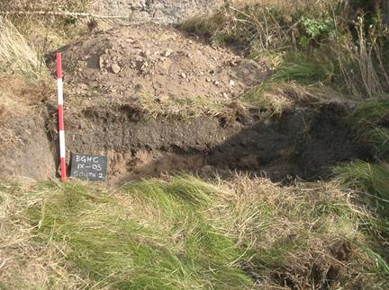
Two small trenches were opened in the SE garden. One, to the NE, was laid our running NW/SE, parallel to Grant Street, whereas that to the SW was laid out at right angles and parallel to the boundary walls between the gardens (Fig. 6). Both proved to be sterile: subsoil was reached under a layer of garden soil generally some 0.25 to 0.40m thick. No features of archaeological interest were encountered.

Fig The SW trench (2) in the SE garden at the Brae; modern dark garden soil overlying silty-sand.
Finds were few in number and modern in character.
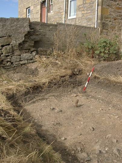
A further trench was laid out running NW / SE across the central garden, to the SW of the lean-to garage built against the gable wall of The Brae. Aside from modern features (e.g. clothes poles), and modern finds, including nineteenth and twentieth century pottery and rusting iron debris, this too proved to be sterile. Undisturbed subsoil was reached at a depth of approximately 0.70m; there was no sign of the ditch encountered in the NW garden (see below), but a strip c. 1.5 m wide next to the wall separating this garden from the NW .was not examined for safety reasons (Fig 7).

Fig 7 The trench in the central garden at The Brae, with the wall between this garden and the NW garden. A modern clothes pole was noted inserted into subsoil below garden soil some 0.30-0.40 m thick, but there were no ancient features.