Professor Ian Ralston
Projects

The aim of this project was to investigate, as far as was possible by digging in private gardens and other accessible places, the triple landward system of the fort at Burghead, shown on the 18th century plan prepared from General Roy’s Military antiquities of the Romans in north Britain, published in 1793 (Fig. 1). The sites investigated therefore lay outwith the areas of the promontory fort scheduled under the Ancient Monuments legislation, and access to the sites considered hereafter was gained through the good offices of members of the Burghead Headland Trust (Figs 2 and 3).
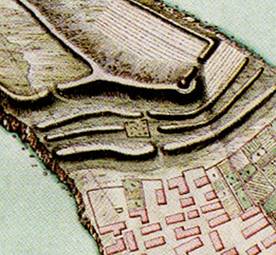
Fig 1 The triple outer works at Burghead from Roy’s 1793 plan, showing St Aethan’s cemetery in relation to the middle bank
In essence, the problem presented by this triple system is whether it represents a series of foreworks, in essence contemporary with the well-known enclosed ‘courts’, elements of which still survive as upstanding features at the apex of the headland, or whether the triple system of banks and ditches, apparently different in character from the substantial walls of the headland courts, represent either an earlier fortification of the headland, presumptively of the pre-Roman Iron Age, or potentially of slightly more recent date than the sandstone-faced and timber-laced walls that have been investigated on numerous occasions on the headland and which seem securely dated within the Pictish period.
There has been no known previous investigative fieldwork on the triple system, and there is no other information about them, except for the fact that Roy’s map of the site shows that the chapel and burial ground of St Aethan’s (the latter still surviving on Grant Street, although its limits have been remodelled) occupies the extremity of one of the banks adjacent to an entrance gap that traverses this system. Previous commentators have noted this juxtaposition and have interpreted it either as evidence that the outer system was in decay when the chapel and its surroundings were laid out or, alternatively, that the existence of the chapel and burial-ground preceded the construction of these banks; this latter hypothesis seems much the less likely.
The aim was thus to investigate the triple system in so far as this could be identified in accessible ground within Burghead, with the intention of examining the form and architecture of the defences, and of obtaining dating evidence, either in the form of artefacts or of organic or other samples that could be processed to provide e.g. radiocarbon dates. The intention was also to seek suitable environmental samples, which could provide information to supplement presently-available evidence on the nature of the Burghead headland some two millennia ago.
The original research design and notes of subsequent discussions with Burghead Headland Trust are attached as Appendix 1.
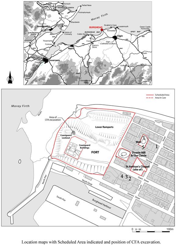
Fig 2 The positions of the 2003 investigations added to the most recent plan of the scheduled areas: 1 the garden of 22 Church Street; 2, 3, 4 the SE, central and NW gardens of The Brae, 35, Grant Street; 5 the Lainie SW of the Burghead Well precinct
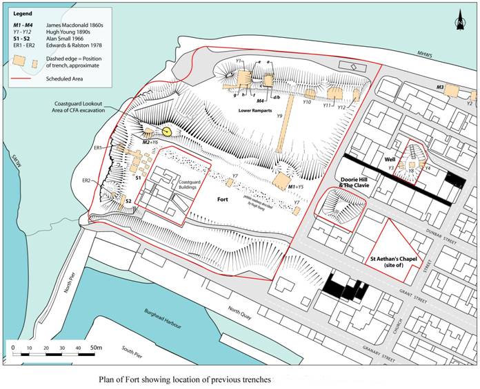
Fig 3 Properties (shaded black) examined in 2003 in relation to the location of previous trenches at Burghead